


Please read these instructions to find a satellite photo image of your home town:
Put your mouse cursor near your location, click down and drag to the middle.
Alternatively, type the name of your location here:
Centre the map around
Now enlarge the map scale by using the + sign on the upper left side of the map. Click on this and the map will enlarge. Repeat the process of mouse dragging to centre the map as necessary.
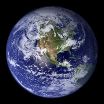
Choose the Map, Satellite or Terrain photo image as you get closer and hopefully you will find your town. Try for the maximum possible expansion of the satellite image photo. In some cases, where higher resolution images exist, it is possible to see cars, in good lighting and clear sky.
The Google satellite map database already includes some more detailed mapping information such as town, road and street maps for the US, UK, Ireland, Europe and Japan. In these cases you can use the detailed road and street maps to home in on your location.
Search for some selected examples of satellite remote-sensing/satellite imagery, such as satellite photos taken from Landsat. See here for satellite images in the infrared, water vapour and visible spectrum images for weather purposes.
For reference purposed the latitude and longitude coordinates of the centre of the map are shown below the map. Look carefully at the centre and you should see the flashing pixel centre marker.
These free aerial photo maps come from a free satellite image database by Google and will continue while they are freely available. Satellite imagery is expensive to obtain and is normally charged for, particularly the higher resoloution imagery which shows your house and home or even your car parked in the street outside your house. If you do the satellite view of some major cities you will see example satellite view images where you can see cars. I've even managed to see the shadow behind my dad's gravestone in the cemetery in Manchester, UK.
Latitude is North - South ( up and down ! ). Longitude is West - East ( sideways ! ). Note zero on the equator and positive in the northern hemisphere and negative in the southern hemisphere. Longitude is zero on the prime meridian - home of Greenwich Mean Time and is positive to the east, across Europe and Asia, and negative to the west, across the Atlantic and the Americas.
Page created 13th December, amended 12th Sept 2006 incorporating Google API Version 2 javascript software. I have reduced the number of markers for countries where there are now more details for France, España, Portugal, Deutchland, Nederland, Danmark, België Belgique, Italie, Hungary, Switzerland, Austria, Sverige, Norge, Suomi Finland, Polska and Serbia Montenegro. Only the USA, Canada, UK, Japan and Hong Kong previously had details to go with the satellite photos.
Feedback please to me, Eric Johnston
Town and city coordinates marked with small square icons and which overlay the satellite photo images and all text and pages on this satsig.net web site are Copyright Satellite Signals Limited (c) 2005 all rights reserved.
kikma.site
Source: www.satsig.net
|
Recent Geodetic and Gravimetric Research in Latin America: Symposium No. 111, Vienna, Austria, August 13, 1991 (International Association of Geodesy Symposia) eBooks (Springer) |
|
Vintage 1872 Map of Topographical map of Atlantic Co., New Jersey : from recent and actual surveys - General-content county map showing rural buildings and landholders' names; the urban insets show real-property lots, building coverage, and some occupants' names. - Hand col. to emphasize municipal boundaries and territories. - Originally printed on 6 s Atlantic City, Atlantic County, Egg Harbor City, Hammonton, Mays Landing, New Jersey, United States Home (Historic Map)
|
Related posts: